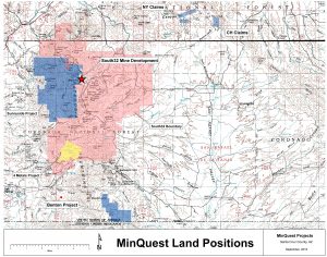
CH Project, Arizona
The CH project is 6 unpatented mining claims located on US Forest lands in Santa Cruz County, Arizona about 6 miles east of South32’s Taylor Ag-Pb-Zn deposit (101Mt @10.5% ZnEq).
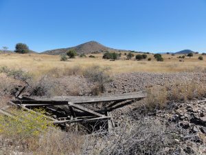
Historic work consists of 3 core holes in the 1960’s and up to 5 rotary holes drilled in the early 70’s. One hole was reported to have intersected about 200 feet grading 0.4% copper with several intercepts of +2% copper. Old workings explore lead-zinc-silver-gold skarn within the property boundaries.
Additionally, 76 surface geochem samples have been collected, a detailed ground magnetic survey was completed (21 lines) and 13 IP lines were completed. A geologic map was compiled from several sources.
The above work has identified several areas of mineralization including –
- Copper mineralized porphyry dikes cutting hornfels and arkose. A mag low with coincident chargeability high suggests a zone roughly a kilometer in diameter.
- Limestone altered to garnet-diopside skarn containing high grade copper-lead-zinc-magnetite- gold mineralization on the northeast side of the property.
- Fractures and veins with dolomitic alteration and +1% copper and +2 opt silver occurring within a early Tertiary dacite.
The property has a well defined footprint of alteration, mineralization and geophysical anomalies providing direct drill targets on the property.