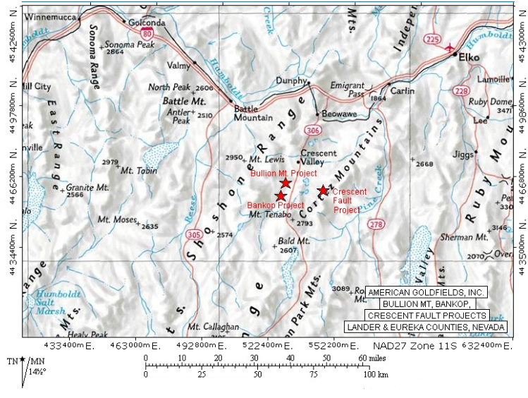
Project Overview
The Bankop Project is comprised of 24 unpatented mining claims covering a total of 480 acres. The project is located about 3 miles northwest of the Pipeline Mine near the town of Crescent Valley, Nevada. Bankop is adjacent to the Utah-Clipper Project on the north end and represents a grass roots exploration property with well defined targets, but no defined resources.
Area Geology
The project covers an area of upper plate siliciclastic rocks along the margins of a significant magnetic high. The siliciclastic rocks are complexly faulted with stacked thrusts of Ordovician to Devonian rocks unconformably juxtaposed. Normal faults displace the rocks and provide conduits for mineralizing fluids to flow. The magnetic high is thought to represent an intrusive at depth. Intrusive activity may provide additional plumbing for a significant hydrothermal cell at depth.
Exploration
Historic work started in the area in the early 1960’s when placer gold was reported in the vicinity. Pits and dozer trenches are apparent within several drainages within the property. Phelps Dodge and AMAX Exploration explored the magnetic high to the west of the property for porphyry style base metal mineralization in the late 1960’s and early 1970’s. Gold exploration was initiated in the early 1980’s when Placer Amex drilled immediately adjacent to the property boundary testing gold in soil anomalies. Since that time Hemlo, Uranerz, Newmont, and American Goldfields have conducted exploration projects within and adjacent to the property. This work identified a system of low and high angle fault zones passing through the project area. The faults and adjacent wall rocks are altered and mineralized in part with gold, silver, arsenic, mercury and antimony.
The most recent work was conducted by American Goldfields. An auger sampling program obtained over 350 samples covering the entire property. Follow-up drilling of seven reverse circulation holes for a total of 2440 feet were completed to test the best gold anomalies. This work defined several fault zones from 15 to 100 meters wide and 700 meters long containing anomalous gold values to 0.8 g/t and silver values to 86 g/t over 5 to 25 feet. The results confirm the existence of a gold and silver-bearing hydrothermal system within the property boundaries extending from the Utah-Clipper area. Continued exploration of this system is warranted to define a trap or adequate host rock that concentrated gold and silver.