Project Overview
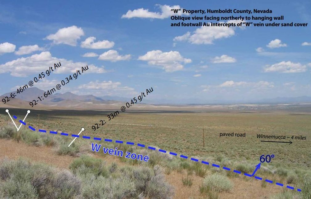
The W Project is located 5 miles north of Winnemucca in Humboldt County, Nevada- adjacent to the county landfill. The project has seen extensive drilling, with over 60 holes completed to date. Initial exploration has outlined a small resource of approximately 1.5 million tons grading 0.87 g/t gold and 12 g/t silver. This resource is defined over a strike length of 230 meters and a width of up to 35 meters. Widely spaced drilling over an additional 1200 meters suggests the potential for similar mineralization along strike. An intersecting structure also exhibits similar characteristics.
Area Geology and Drilling
The mineralization is hosted in a quartz-calcite vein that is within Mesozoic sediments and intermediate dikes. Wide spaced drilling over an additional 1200 meters indicates similar size. An intersecting structure consists of similar
Initial exploration efforts consisted of 32 shallow, vertically oriented holes, with an average depth of 50 meters. Half of the holes lost circulation within alteration and mineralization. An additional 14 holes were drilled to test continuity at depth. Thirty percent of these holes also lost circulation and failed to meet the depth objective. These holes intersected gold and silver mineralization of up to 9W Sum 20200 meters grading 0.3 g/t gold and 5 g/t silver. The trace elements from some of these holes indicate +0.2% antimony, 0.5% arsenic, 10 ppm mercury, and 0.15% tungsten over 20 meters or more. The quoted values were at the upper limits of detection for the lab and were not followed up.
Geophysical surveys conducted on the property show a strong correlation with the known mineralization defined by drilling. This geophysical anomaly extends for an additional 1000 meters along strike, concealed beneath sand cover, suggesting significant exploration potential.
.