SP Project, Arizona
The SP project consists of 40 unpatented mining claims located in the Verde mining district of north-central Arizona. This equates to approximately 800 acres of land.
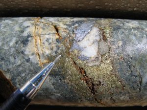
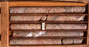
Historic work by the Squaw Peak Mining Company included 4200 feet of workings and produced approximately 1000 tons of ore from a stope which averaged 1.2% copper, 0.7% molybdenum with silver and gold credits. Amax, Asarco, Bear Creek, Callahan, Phillips Petroleum, Essex, Selection Trust, American Copper and Regal Resources explored the property over the last 70 years. The work incldued geophysical surveys, soil and rock sampling at surface, underground sampling and a total of 59 core holes and 19 churn holes for 40,567 feet or an average of ~520 feet per hole. This work identified a resource of ~45 million tons grading 0.37% copper and 0.02% molybdenum. A geologic resource utilizing all of the wide spaced drilling suggests ~285 million tons grading 0.22% copper and 0.01% molybdenum.
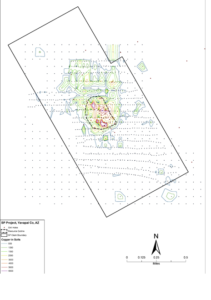
Two additional targets are indicated from the soil geochemical and magnetic geophysical surveys. The north target is highlighted by a mag low anomaly, heterolithic breccia and geochem in soil and rock. The south target is represented by soil geochem and mag low anomaly.
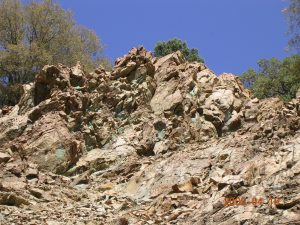
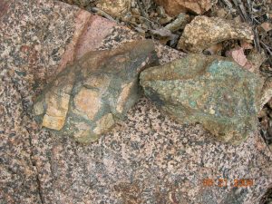
The geology is composed of Proterozoic granodiorite to the south faulted against Proterozoic greenstone to the north. Three breccia bodies are localized along the contact of greenstone and granodiorite. Proterozoic units are intruded by a Laramide(?) monzonite stock and porphyry dikes.
A high grade core located on the south margin of the resource is possible a “pipe”.
Squaw Peak has several direct drill targets defined by geology, geophysics and geochemistry with an upside potential of 500 million tons. A deep porphyry target may be associated with the breccia bodies
The project is currently leased to Copper Resource Group, a private company. https://copperresourcegroup.com/squaw-peak/